
Experiencing the TVA Honeycomb Trail at Lake Guntersville

Rolling mountain terrain and lake scenery await hikers on the Honeycomb Trail, the Tennessee Valley Authority’s longest hiking trail in Alabama.
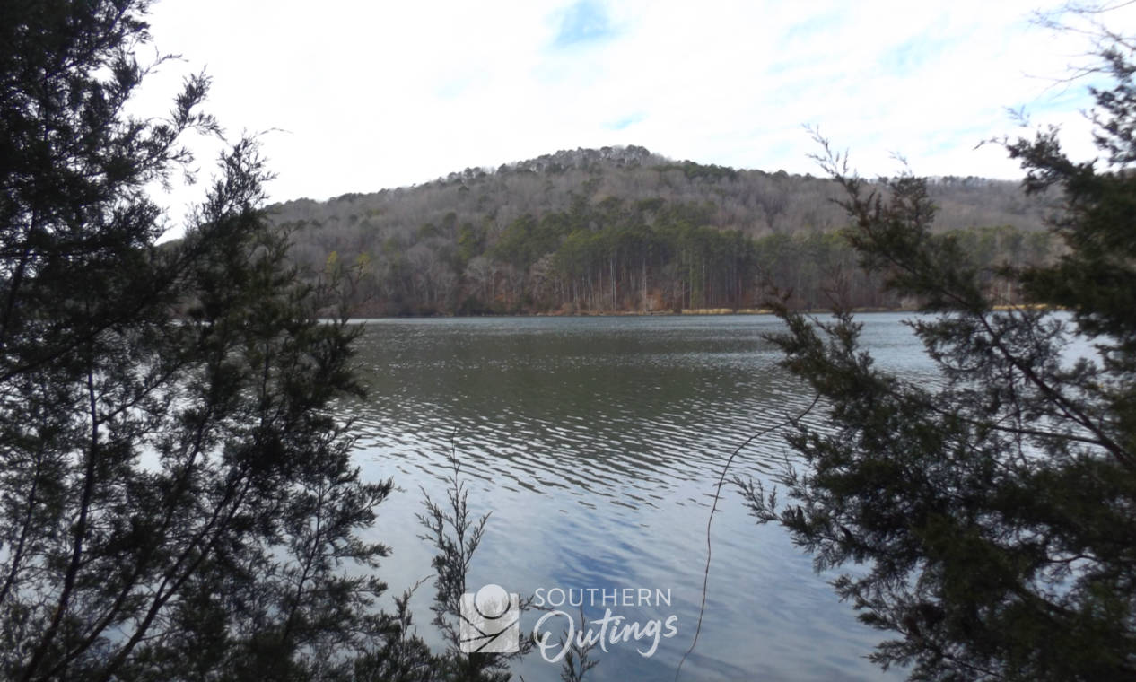
Hikers of all abilities who live in the north Alabama area should get to know the 9.3-mile Honeycomb Trail located near the Guntersville Dam. The woods and rugged Cumberland Plateau topography contain many interesting features like a variety of tree species, ravines, streams, rock formations, small caves and wildlife habitat. The majority of the trail is rather smooth whether you are hiking along the lake’s edge or the southern edge of Bishop Mountain. These features also make it a great path for trail runners, and, according to TVA’s mountain biking web page, enjoying Honeycomb on two wheels is also an option. Getting to either of its two trailheads is a short, scenic drive from Huntsville or Guntersville.

Distance options
Naturally, when it comes to a 9.3-mile path of this variety, there are unlimited options for how far you may go. Out-and-back hikes from an hour to many hours can be quite enjoyable. Or, planning a one-way hike from one end to the other is practical if you are fit enough to walk for 6 to 8 hours, and your party leaves a second vehicle at the opposite end of the trail or a shuttle is arranged to take you back to your starting point.
I’m sure long-distance hikers go the entire 18 miles from one end to the other, and back, from time to time.
Access on the west end of the trail is at the picnic area that overlooks the dam. Paved parking is plentiful there. At the eastern trailhead, you’ll see a trailhead sign at the small gravel parking lot just a few yards from the Honeycomb Campground’s boom-gate. That lot will accommodate only about four vehicles. A large boat trailer lot at the TVA boat ramp is only about 100 yards way in case the small lot is full.

Due to what could be an overwhelming distance, most day hikers should plan to go out about two to four miles, and then turn around. A six-mile hike on this terrain will take faster-than-average walkers from three to four hours to complete. If they take a break or two, average hikers should allow over five hours to cover six miles.
If you start at the dam, going as far as the northern tip or eastern shoreline of Hambrick Hollow is a good choice. You will see the western third of the trail while enjoying some moderate uphill portions, some nice mountain slopes filled with big hardwoods and some of the best lakefront portions.

If you start on the east side, the Honeycomb Creek portion of the lake provide some of the best scenery due to the small mountains surrounding it. A good choice is hiking until you reach the beaver pond found at Pumpkin Hollow. You will see much of the eastern third of the trail by the time you reach the pond. A small round mountain on a peninsula is found between the RV campground and Pumpkin Hollow. You can follow the trail along the edge of the lake as it circles the little mountain, or a straight, short path on the north side of the peninsula provides a shortcut that reduces the distance by about a mile. On my most recent hike from the eastern trailhead, I took the trail by the water going out to the beaver pond, and then took the shortcut going back. That hike was within a few yards of being exactly 5 miles.

Hambrick Hollow and Pumpkin Hollow are excellent places for birdwatching and for taking in lake scenery. Expect to see evidence of beavers anywhere along the shore. Whitetail deer, chipmunks and armadillos are common. Look for bald eagles in tall pines as they often roost near the water. The hollows are among the best places at the lake for enjoying fall colors. While it can be very quiet, you should expect to hear a good number of loud boat motors most of the time.
Hambrick Hollow gallery


Pumpkin Hollow gallery


TVA public lands
The TVA manages 293,000 acres of land and 11,000 miles of shoreline along the edge of the Tennessee River and its tributaries. Most of this mostly wooded land is owned by the USA and is open to the public for recreational purposes. Among the amenities are dozens of trails totaling almost 180 miles in length.
The 9.3-mile Honeycomb Trail is one of two long TVA trails found in the forest adjacent to the Guntersville Lake’s dam. It’s on the north side of the river, while the 6-mile Cooley Cemetery Trail is on the south side.
Named protected lands found along the Honeycomb Trail include the Hambrick Hollow Habitat Protection Area, the Honey Bluff Habitat Protection Area, the Honeycomb Creek Habitat Protection Area and the Honeycomb Creek Small Wild Area.
Unlike hiking at a state or national park, the TVA doesn’t require you to stay on the trail. You are welcomed to explore the woods to discover things like photogentic spots along the shore, rock formations or older stands of trees. But you must follow state and federal laws concerning caves, camping, wildlife, vegetation and more. For details, visit the TVA Public Lands rules page.
What else to know before you go
Water views can be enjoyed for a majority of the trail, especially in the winter.
Elevation shifts on the Honeycomb Trail are moderate. It’s about 595 feet above sea level at the water and about 850 feet above sea level at the trail’s highest point.
Those accustomed to using other trails in northeast Alabama will find the terrain and woods to be very similar to what’s found at nearby Cathedral Caverns and Lake Guntersville state parks.
For the most part, the path is easy to follow. There are some sections where you will have to watch closely in order to see where your next steps should take you. It’s not a big problem since you know the trail runs parallel to the water’s edge and another white blaze used to lead you must be somewhere up ahead. There are five bluff overlooks along the TVA Honeycomb Trail, but you will have the hike about four miles from either end in order to reach the first, so enjoying those lofty views are for hikers ready to go a total of 8 miles or more while adding an extra uphill section. There are eight or nine mountain streams but you should expect to find most of them to be dry except under very wet conditions. The stream at Hambrick Hollow is the most likely one to have some water upstream from the lake’s edge.
The part of Alabama Highway 431 that will bring you to the trail features some good lake scenery, so you should plan to enjoy the views while getting to either end of the trail. If you come by boat, the scenery is even better. There is a TVA-managed dock near each trailhead.
Fun facts
While the TVA Honeycomb Trail closely parallels the shoreline while spanning 9.3 miles in the woods, it’s only 4.3 miles by boat from the dock near the dam to the dock near the Honeycomb Campground entrance. It’s 6.7 miles between the same points when traveling by automobile.
Itinerary ideas
Campers who also hike and enjoy water sports will find an ideal setting at the western portion of the trail. You can book sites for RV or tent camping, or rent a cabin at the large and beautiful Honeycomb Campground, which is operated by Vista Recreation. They also have four primitive campsites. It’s easy to imagine a weekend filled with kayaking, hiking, fishing and roasting marshmallows.
Birders who hike will find lots of places for trying to spot woodpeckers and all sorts of small woodland birds. The hollows are good for spotting eagles, hawks, great blue heron and kingfishers.


The dam side is popular for fishing from the shore, picnicking and checking out the water views on each side of the 84-year-old dam. There are lots of grassy spaces.
Related posts
Seven TVA sites worth adding to your north Alabama outdoor travel plans
Enjoy a self-guided bald eagle adventure at Guntersville Lake
Mountain-lake setting heightens the wow factor of Guntersville’s historic downtown
Top 16 public spots for enjoying Guntersville Lake
From picturesque valley to timbered mountaintop: Hiking at Cathedral Caverns State Park
A hiker’s guide to the trails at Lake Guntersville State Park