
Lake Guntersville: Enjoying the TVA Cooley Cemetery Trail

Discover mountain streams and lake scenery along this hilly 6-mile trail found on the Guntersville Dam’s south side
A good number of hikers and horseback riders enjoy the Cooley Cemetery Trail each week. According to the Tennessee Valley Authority’s webpage, primitive camping and mountain biking are also allowed. Trail running should be okay on any trail.
Plan to explore Georgia Mountain’s forested northern slopes on this wide path that closely parallels the lake’s shoreline. Expect undulating topography that allows you to walk up to the edge of the water in a few places.
Water and dam views can be enjoyed for much of the trail in the winter.
The western trailhead is only seven-tenths of a mile from the dam. It’s 10 miles from downtown Arab, 11 miles from the Sunset Drive park in Guntersville and 23 miles from Huntsville’s Ditto Landing.
You’ll find a Cooley Cemetery Trail map displayed across the street from the Cave Mountain Small Wilderness Area parking lot. Look for the small brown sign for a path a few yards to the right of the map, or walk a few yards further to enter at the gravel road.


You’ll pass under several power distribution lines in the first third of a mile. Enjoy your first elevated view of the dam from that area. Keep going and you’ll find a dirt trail that is wide enough to allow TVA to use ATVs to get to downed trees. Perhaps it was a logging road before TVA was created.
The public is not allowed to enter with motorized vehicles.
The hollows
About 1.6 miles from the parking lot, you’ll reach Mill Hollow, the first of four small such inlets. Kirk Hollow is found at the east end of the trail, and two small unnamed hollows are found in between. Ideal for birdwatching, outdoor photography and fishing, each hollow features beautiful scenery where a small stream or branch flows into the lake. The fall colors can be stunning. You may see signs of beaver activity near the edge of the water. Look for hoove and paw prints in the sediment found in such places.


What else to expect along the trail
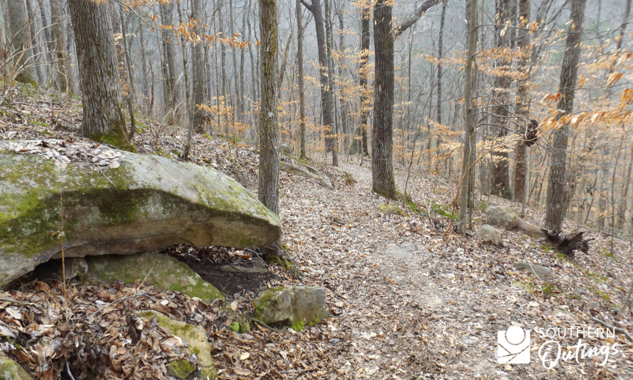
Overall, the trail is rather smooth with fewer than expected roots and rocks to deal with. The elevation changes are mostly mild with a few steep portions. It’s about 595 feet above sea level at the water and about 820 feet above sea level at the trail’s highest point.

Currently, trees along the trail are not marked with paint to lead the way. They’re not necessary on such a well-defined trail. But there are a few white metal arrows found in spots where the route is uncertain.


Distance and itinerary options
Out-and-back options can be of any distance you choose. Hikers that can leave a vehicles at each end, or have a shuttle arranged, can cover almost exactly 6 miles. A 12-mile out-and-back hike would be out of the question for most people. Hiking from the parking lot to Mill Hollow and back — about 3.2 miles round trip — is a good 1.5- to 2-hour option. It would be easy to recommend a 7.8 mile hike to the point past the second hollow and back. At that point, you will find a chimney near the shore where a house stood before the river was dammed. Horseback riders use the spot as a horse camp. It would be a good area for rough camping in a tent. It would be a 3- to 4-hour option for most out-and-back day hikers.


You can see the dam in the distance from that spot. Combining hiking with primitive camping opens up the possibilities to cover a lot of ground. I’m sure some folks combine primitive camping, hiking with canoeing or kayaking from time to time.
Other itinerary ideas included exploring the Cave Mountain Small Wild Area and trail adjacent to the parking lot during the same trip, or checking out the public recreation and education facilities on the south side of the dam.
You get to the south side of the dam and the Cave Mountain/Cooley Cemetery Trail parking lot via Snow Point Road. You’ll enjoy a scenic mountain descent that’s steep in some places. If time allows, you can check out the waterfall on Shoal Creek behind the convenience store at the corner of Snow Point Road and Union Grove Road (map).
See also:
- Exploring the TVA Cave Mountain Trail at the Guntersville Dam
- Seven TVA sites worth adding to your north Alabama outdoor travel plans
More details
Low spots can be very muddy during wet-weather periods, and a couple of them at the water’s edge can be impassable following very heavy rains.
The eastern trailhead is in a remote area near the old cemetery for which it’s named. Look for it at the end of Manchester Road.
Another long TVA path, the 9.3-mile Honeycomb Trail, is found on the other side of the river. But, this dam cannot be crossed to get to it. Although the trailheads are less than two miles apart by line of sight, it’s a 30-mile drive in a car.
TVA oversees almost 180 miles of trails along the Tennessee River and its tributaries, and adjacent to the dams. About 36 of the 180 miles are in north Alabama.


Related resources